What is a geotechnical survey?
 A geotechnical survey is the first step in the construction or consolidation of a site. It includes information about soil consistency and structure, groundwater level and recommendations for the technical project.
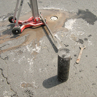
Following the drilling, the samples collected from the ground are taken to the lab for analysis. Based on these results and field observations, the geotechnical report is devised, which together with the drilling records represents the documentation that is delivered to the customer.
A geotechnical survey required for the construction of a residential building involves:
- the execution of one or more boreholes on the terrain on the construction will be placed
- collection of soil and water samples (if applicable)
- laboratory analysis of the soil and water samples
- preparation of the geotechnical report and the checking of the documentation by an authorized MLPAT "Af" expert
The following information must be specified in the case of a geotechnical survey for a construction:
- footprint of the building
- land area on which the building will be located
- land slope
- land closeness water (lake, stream, river)
- common walls with existing buildings
- the height of the building (basement, basement, ground floor and number of floors)
- geographical location where the building will be located
Before you buy a plot it is essential to ask for a survey to know what can can be built on that land.
There are also laws by which any proposed rehabilitation, consolidation, modernization, refurbishment of an old building or construction of new buildings must be based on geotechnical surveys, otherwise the building permit is not granted.
So if you need a geotechnical survey, you can contact us with confidence.